Tafuta
Kiswahili

English


Overview
The Eyasi-Wembere Basin, located in Northern Tanzania along the Eastern Branch of the Great East African Rift System, covers approximately 10,634.9 square kilometers across five administrative regions: Tabora (Igunga), Shinyanga (Kishapu), Arusha (Karatu), Singida (Shelui, Kiomboi, and Mkalama), and Simiyu (Meatu). As one of the frontier areas within the rift system, the basin’s geology closely resembles that of successful petroleum provinces such as Uganda’s Albertine Graben and Kenya’s Lokichar Basin, where significant oil discoveries have been made. The basin’s proximity to the Hoima-Tanga oil pipeline further reduces economic risk by facilitating cost-effective crude oil transportation and enhancing the potential for future commercialization.
Acquired, processed, and interpreted 11,323 line kilometers of high-resolution airborne gravity gradiometry (AGG) and magnetic data to map subsurface structures.
Fieldwork was conducted to confirm the presence of geophysical anomalies and assess essential components of the petroleum system, such as hydrocarbon seepages, structural features, and sedimentary layer configurations.
Three stratigraphic boreholes were successfully drilled at Kining’inila, Nyalanja, and Luono to obtain subsurface geological data and validate stratigraphic sequences. In parallel, both 2D and 3D modeling of the previously acquired airborne gravity gradiometry (AGG) data were conducted to enhance understanding of the basin’s structural framework and overall geological architecture
Environmental Impact Assessment (EIA) was conducted in preparation for 2D seismic survey activities. The assessment complied with the Environmental Management Act of 2004 and the Petroleum Act of 2015. Its purpose was to evaluate the potential environmental and social impacts of the planned operations and to develop appropriate mitigation and management measures to be implemented throughout all phases of the project.
Both direct and indirect hydrocarbon detection methods were employed, including a surface geochemical survey using Amplified Geochemical Imaging (AGI) and remote seep detection through satellite imagery. Installation, retrieval, and analysis of geochemical samples were completed by February 2023. Final interpretation of the data revealed geochemical indicators suggestive of hydrocarbon presence within the Eyasi-Wembere Basin.
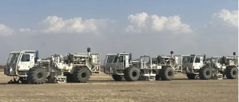
African Geophysical Services (AGS) was contracted to acquire and process 260 line kilometers of 2D seismic data in the Eyasi-Wembere Block. Acquisition began on 15th July 2023 and was completed, including environmental restoration, by 31st October 2023
African Geophysical Services is currently acquiring a total of 914.7 line kilometers of additional and infill 2D seismic data. As of December 2024, 430 line kilometers have been completed. To facilitate operations, a new camp has been established near the survey area at Endesh. Acquisition of 349 line kilometers over Lake Eyasi is underway, with expected completion in November 2025